


Product Details
+
UgCS ENTERPRISE unlocks the full capability of UgCS, including all the features of UgCS PRO and EXPERT with the addition of UgCS ENTERPRISE exclusive features such as multi-node deployment and live video streaming.
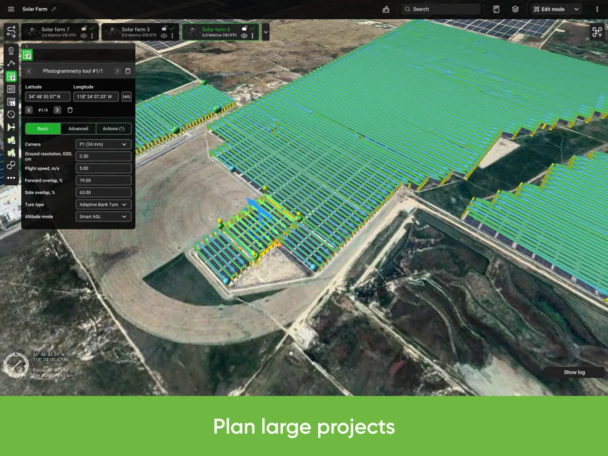
It is designed for deployment on small and large scale companies employing drone pilots for various purposes such as infrastructure surveillance, security, law enforcement, aerial video monitoring, LiDAR data collection and other purposes. It is also used by professional drone pilots and search and rescue (SAR) teams who require video streaming.
Discover why UgCS ENTERPRISE is the top choice for small and large scale companies using drones.
Features of UgCS ENTERPRISE
- Up to 10 simultaneous drone connections
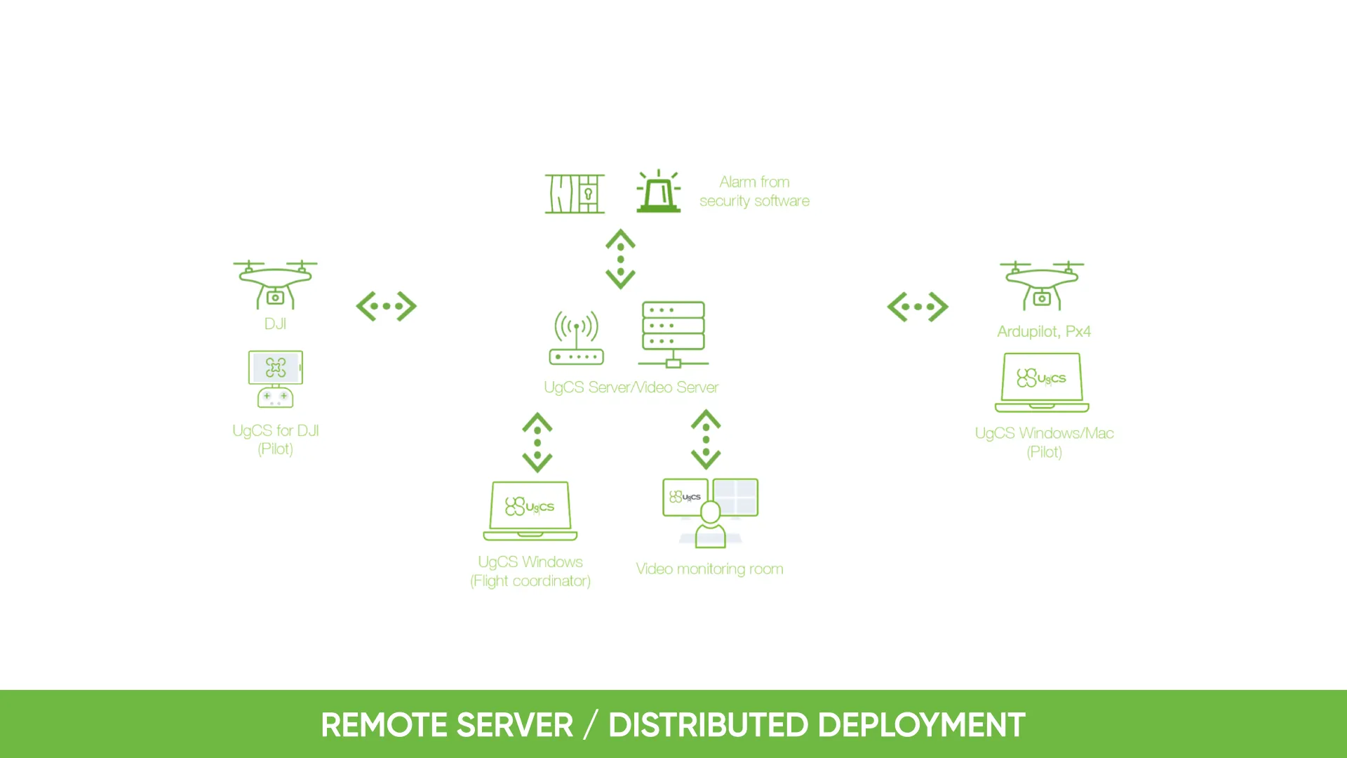
- Ability to run a centralized UgCS telemetry and video server and have pilots from the field connect over a VPN
- from UgCS for DJI to UgCS Video Player on Desktop
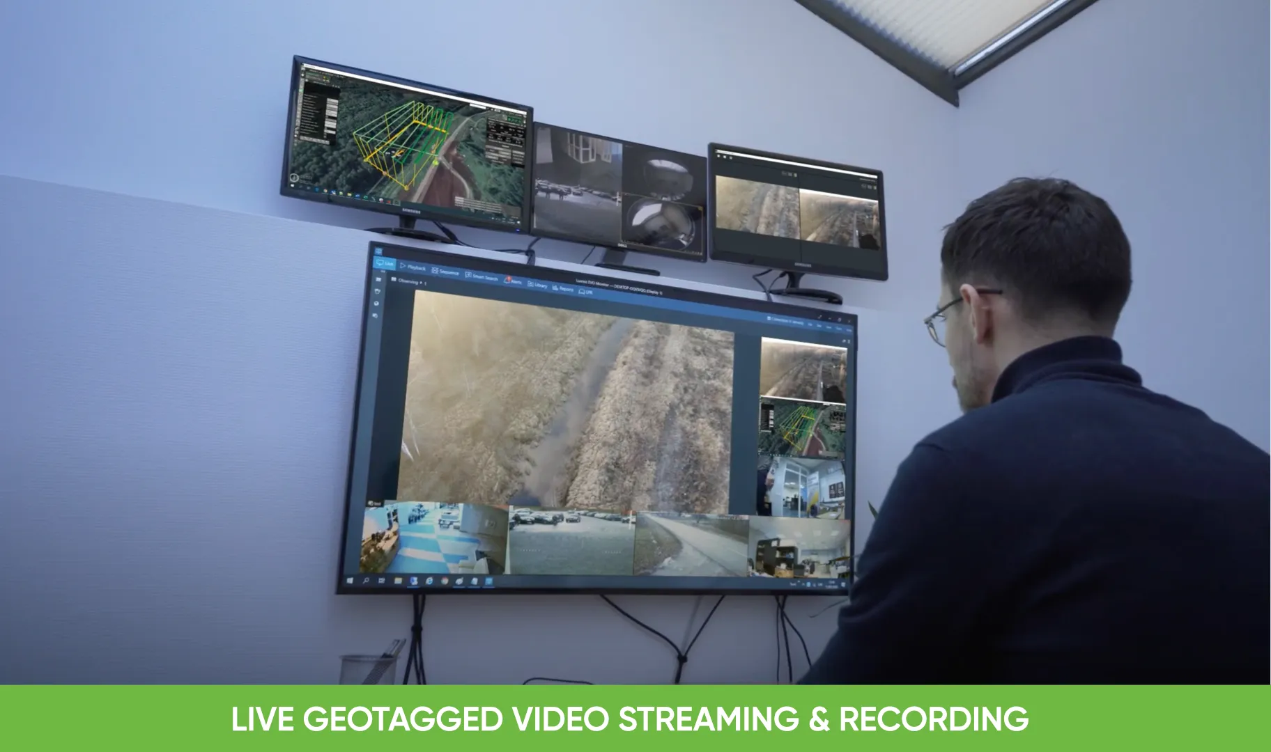
- Local video recording embedded metadata (geolocation, timestamp, vehicle ID and other)
- Video live streaming over RTSP to VMS (such as Luxriot, Milestone)
- Multiple SDK connections
- *ADS-B Transponder support
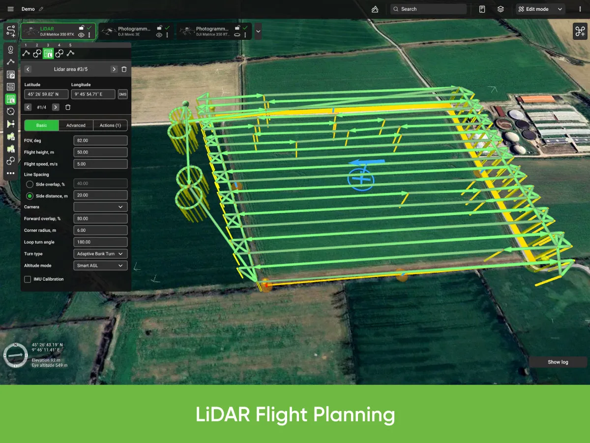
Features of UgCS ENTERPRISE for LiDAR surveys
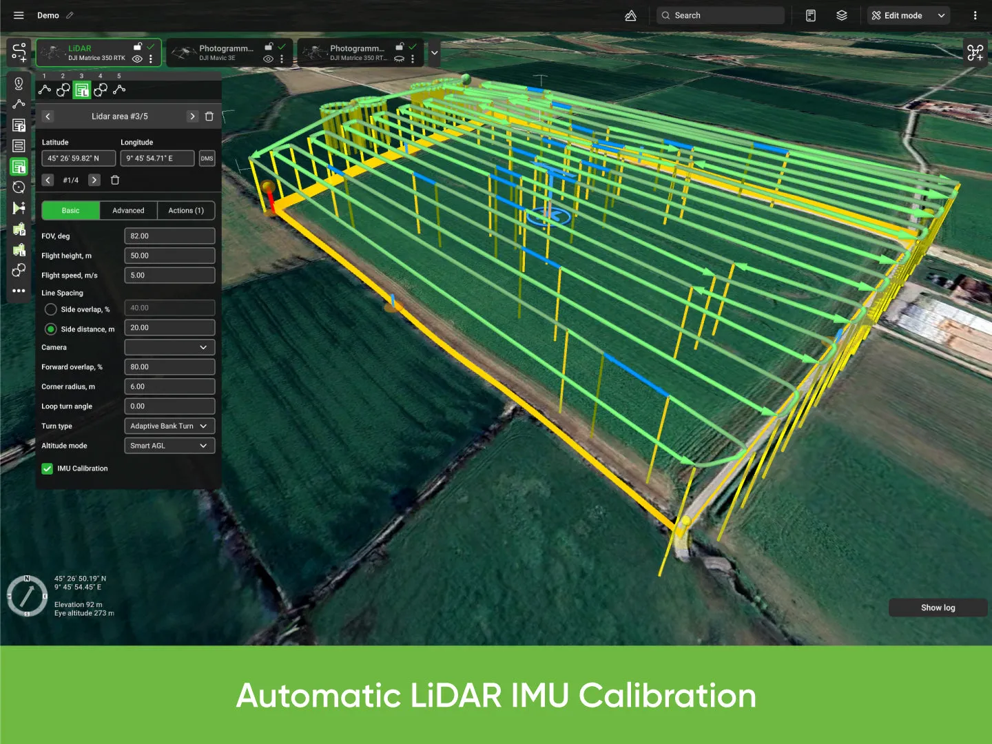
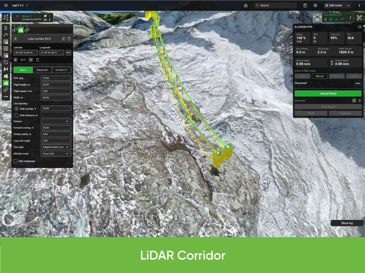
- LiDAR Area and LiDAR Corridor tools
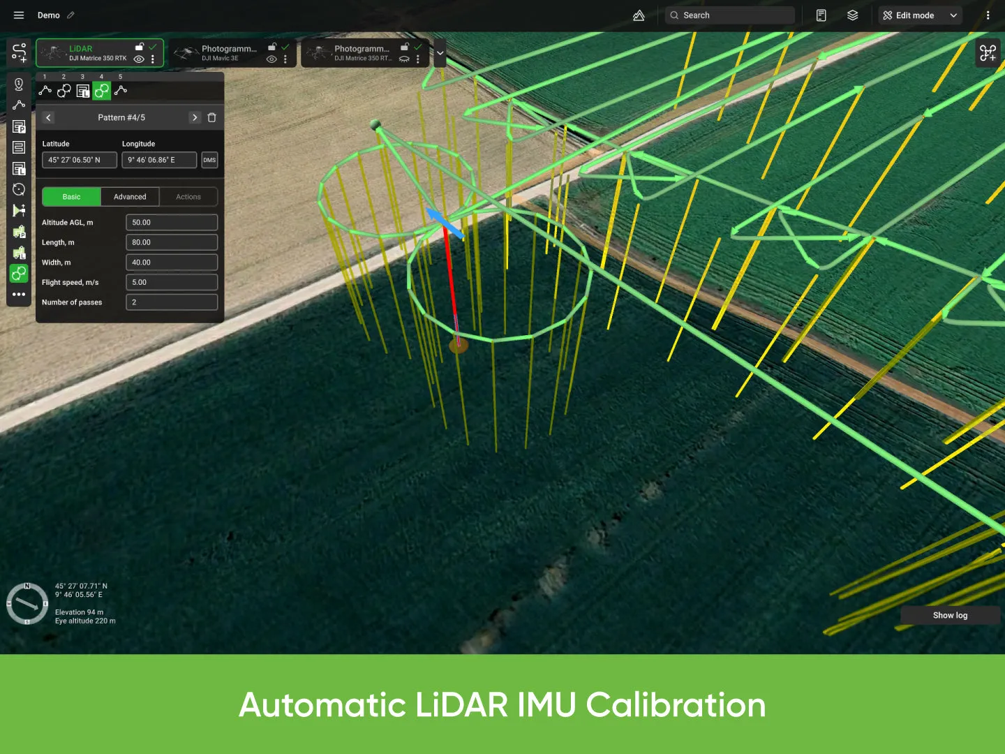
- IMU Calibration route pattern (figure eight)
- IMU Calibration actions (figure eight, U-turn/J-hook)
- LiDAR flight planning based on FOV value
- Adjustable corner radius for smooth cornering
- Loop turns for additional IMU calibration
- Adjustable LiDAR area buffer size
Other features of UgCS ENTERPRISE
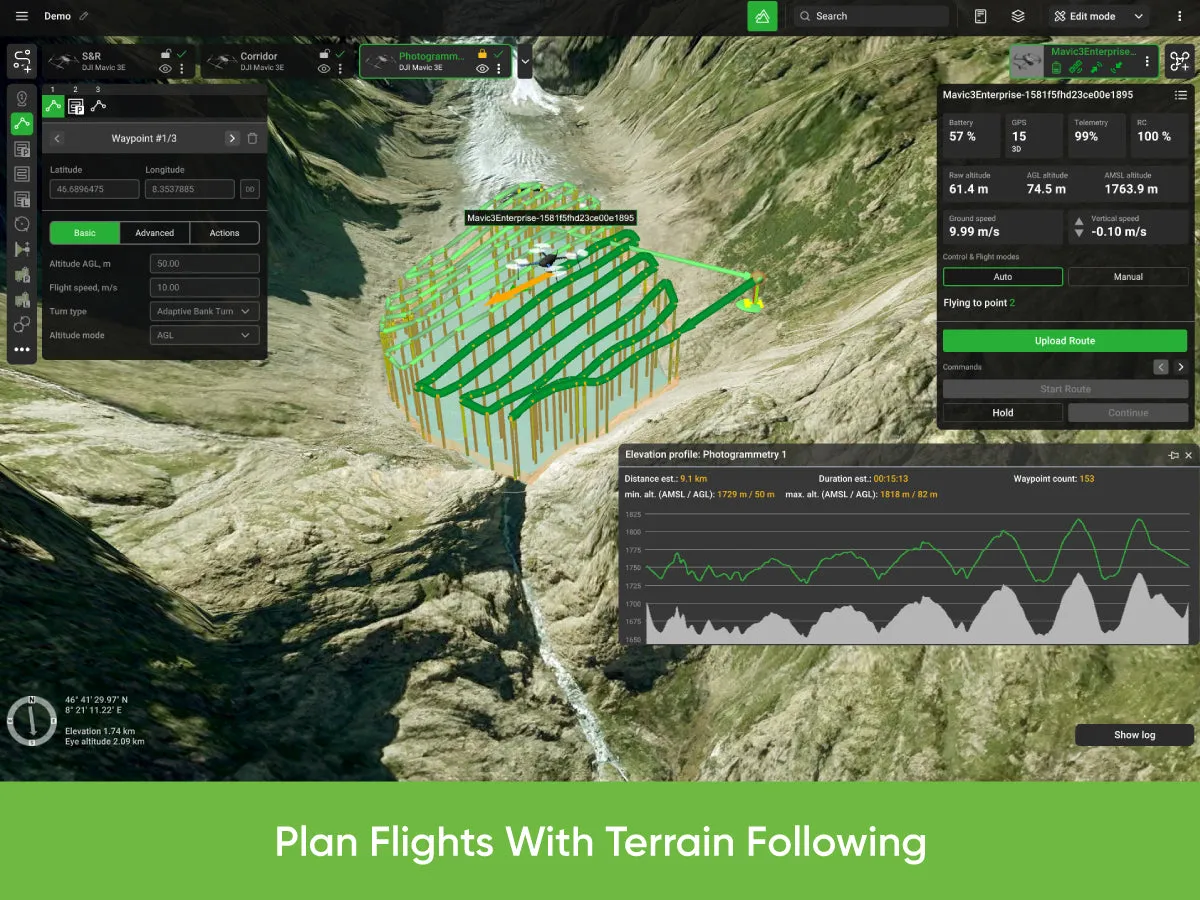
- Plan flights with terrain following
- 3D flight planning interface
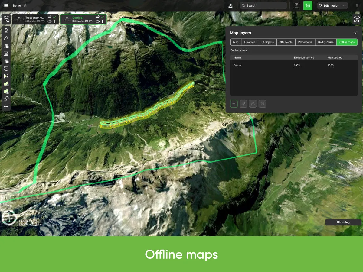
- Offline maps (fly without internet connection)
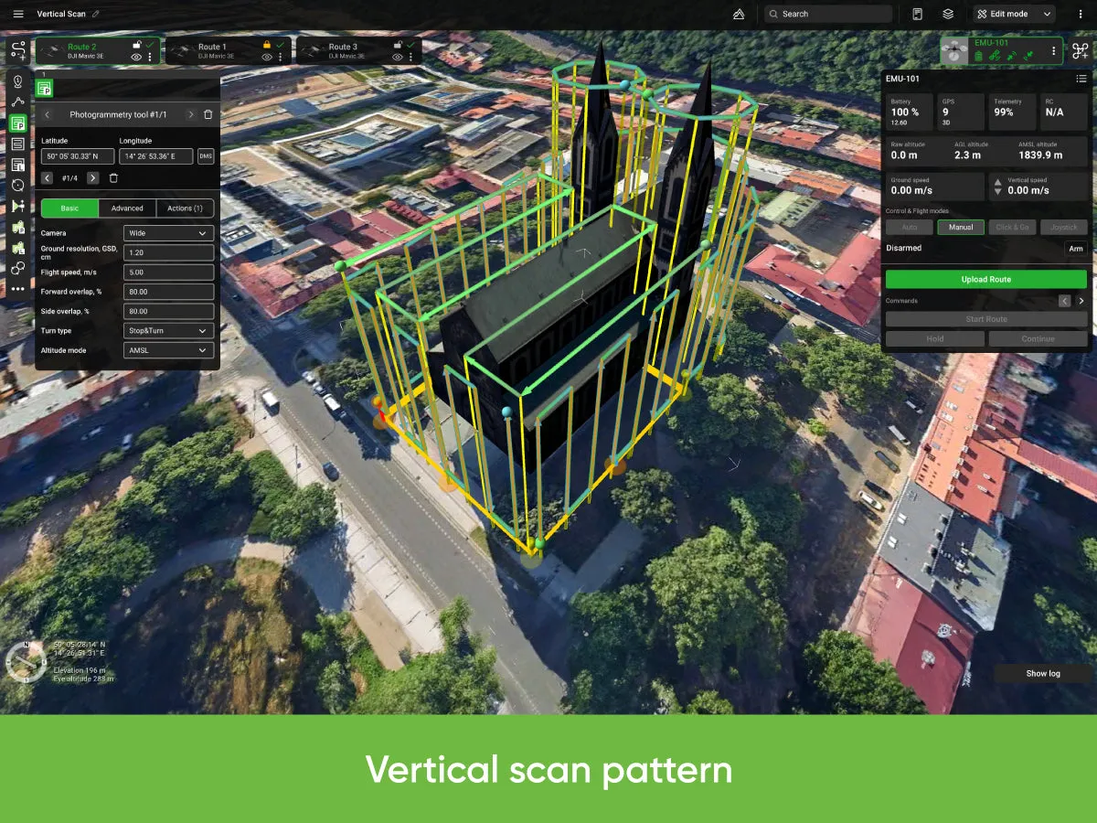
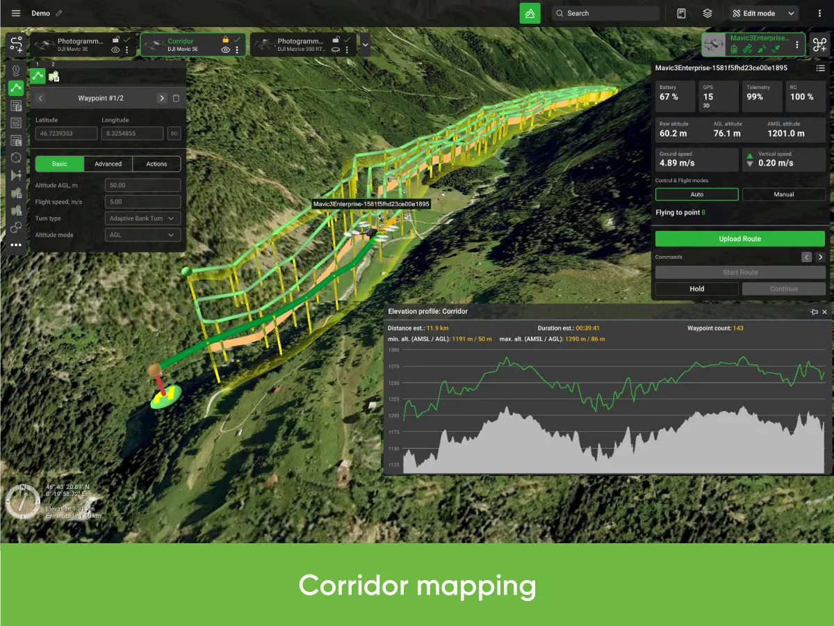
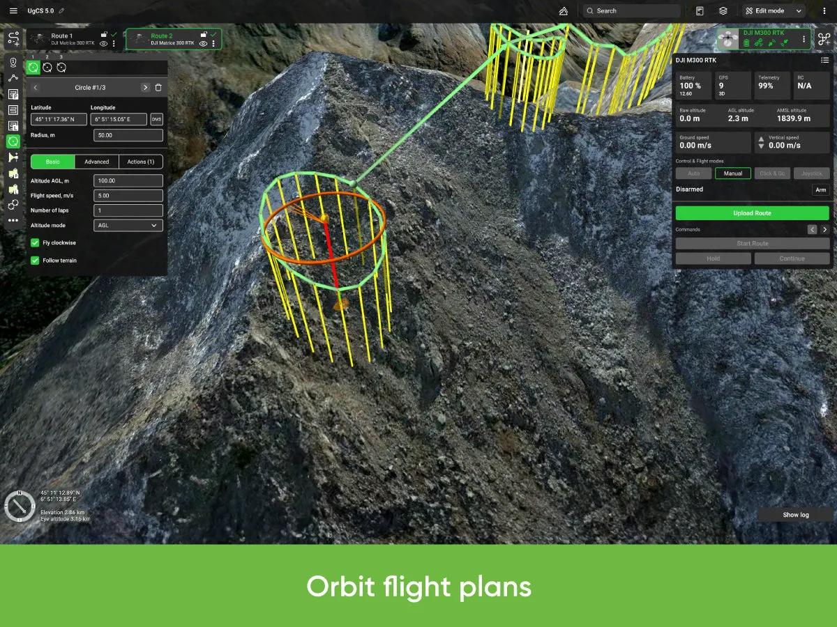
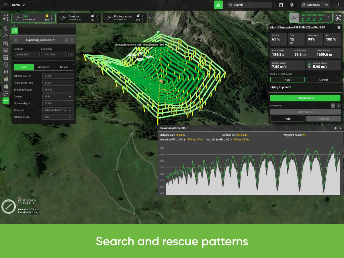
- , , Corridor mapping, SAR, Linear, Circle, Waypoint, Perimeter, Area Scan flight planning tools
- Route import from KML/CSV data
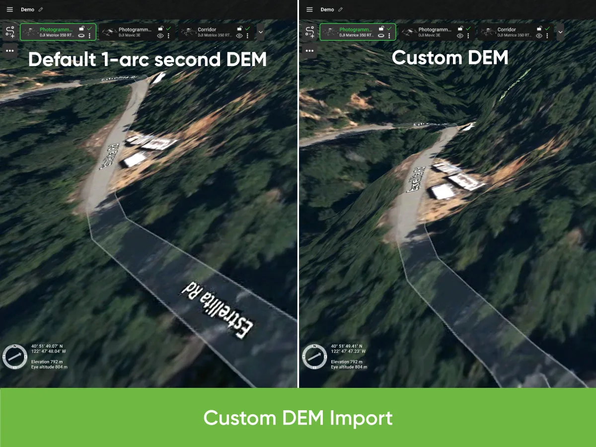
- DEM/DSM elevation data import from .TIF format
- Preview flights with respect to terrain elevation profile
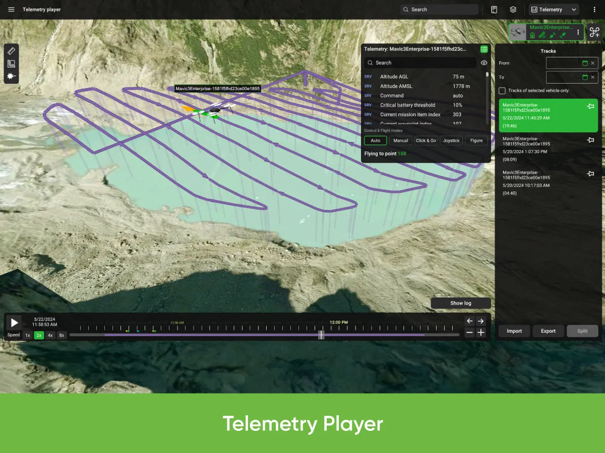
- Automatic telemetry recording
- Geo-referenced image import
- Create custom no-fly zones (NFZ)
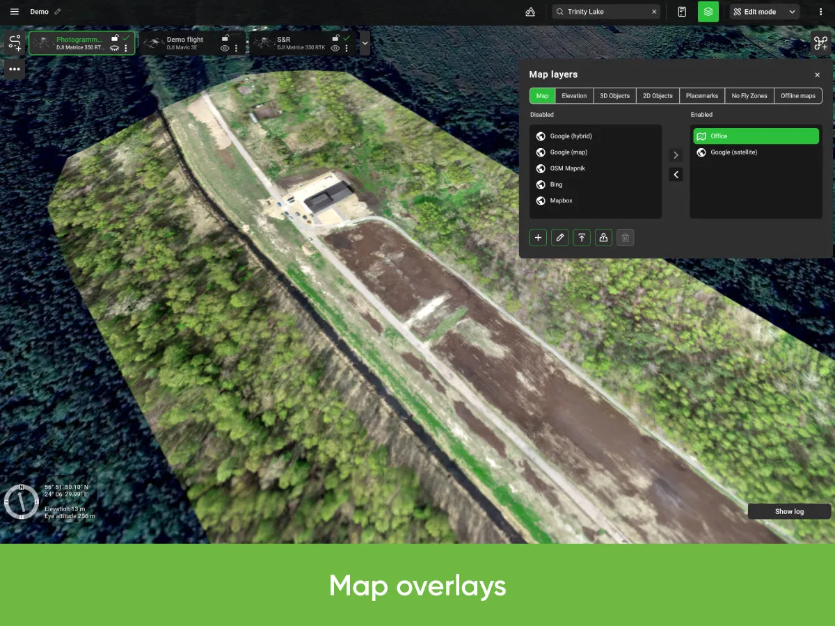
- Custom map overlays
- ADS-B Receiver support
- Compatible with UgCS Mapper to process images and create map overlays.
Supported Drones
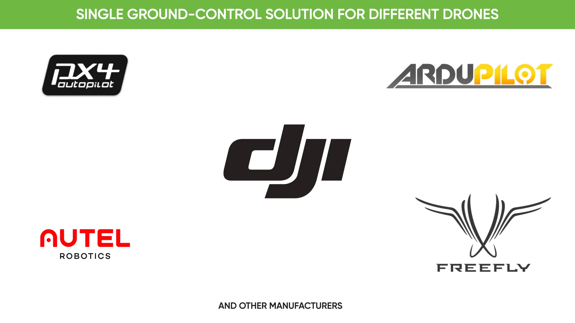
- UgCS supports most popular UAV platforms including DJI M300, M600, M2X0, Inspire, Phantom series, Mavic series; MAVLink-compatible drones (Pixhawk with ArduPilot/PX4).
UgCS ENTERPRISE annual subscription
- Annual subscription - automatically charged yearly, until you cancel
- Includes Support & Updates
- Provides access to the newest version of UgCS
- Cancel any time - no cancellation fee!
- Deactivation of the UgCS license code in the UgCS's software doesn't cancel the subscription agreement!
Not sure if UgCS is right for you?
- Take a look at the

![Maretron Micro Field-Attachable Connector - Female [FA-CF-ST]](https://www.advanceddocu.shop/image/maretron-micro-field-attachable-connector-female-fa-cf-st_NRqFL6_285x.webp "Maretron Micro Field-Attachable Connector - Female [FA-CF-ST]")


