


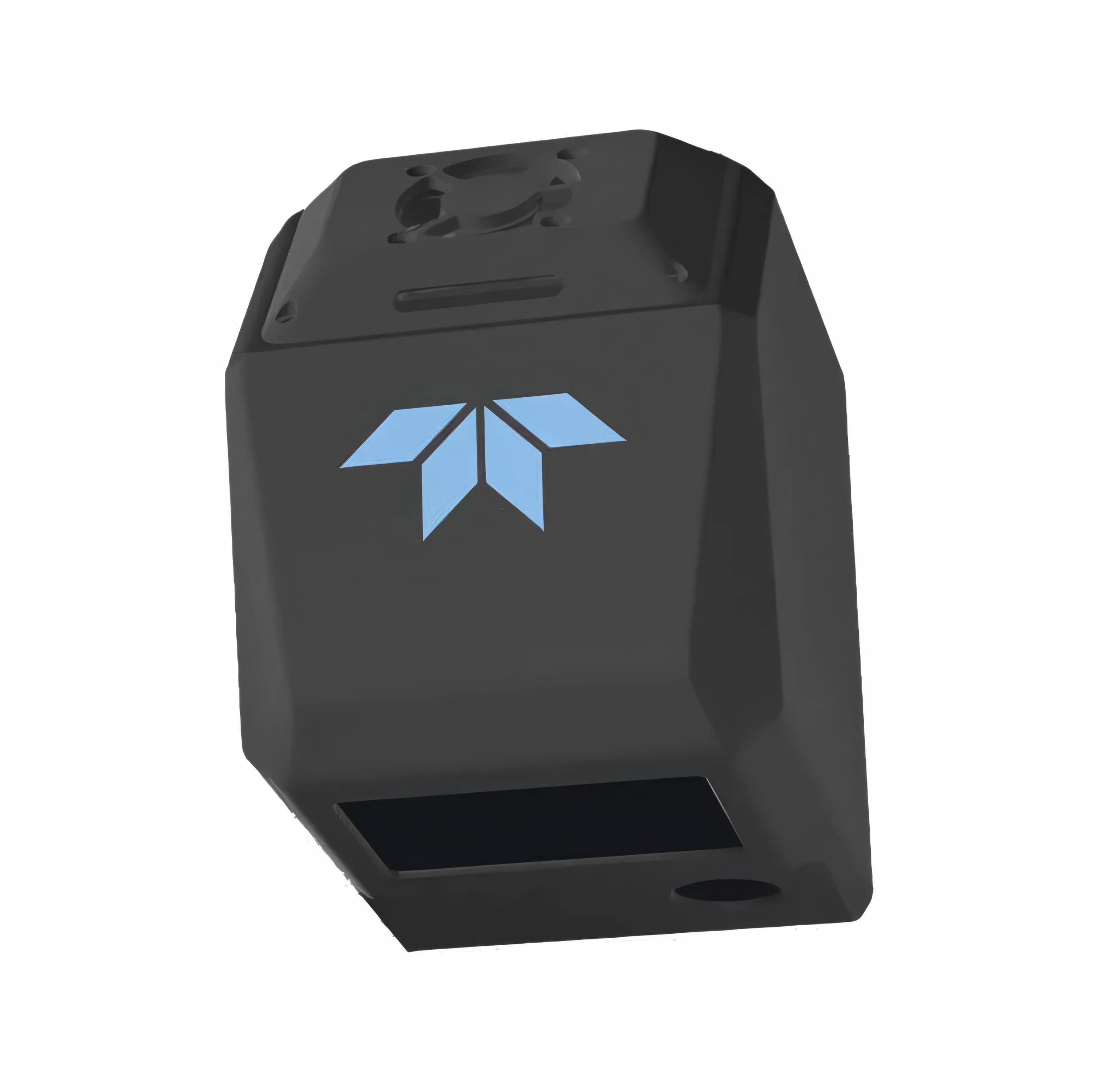
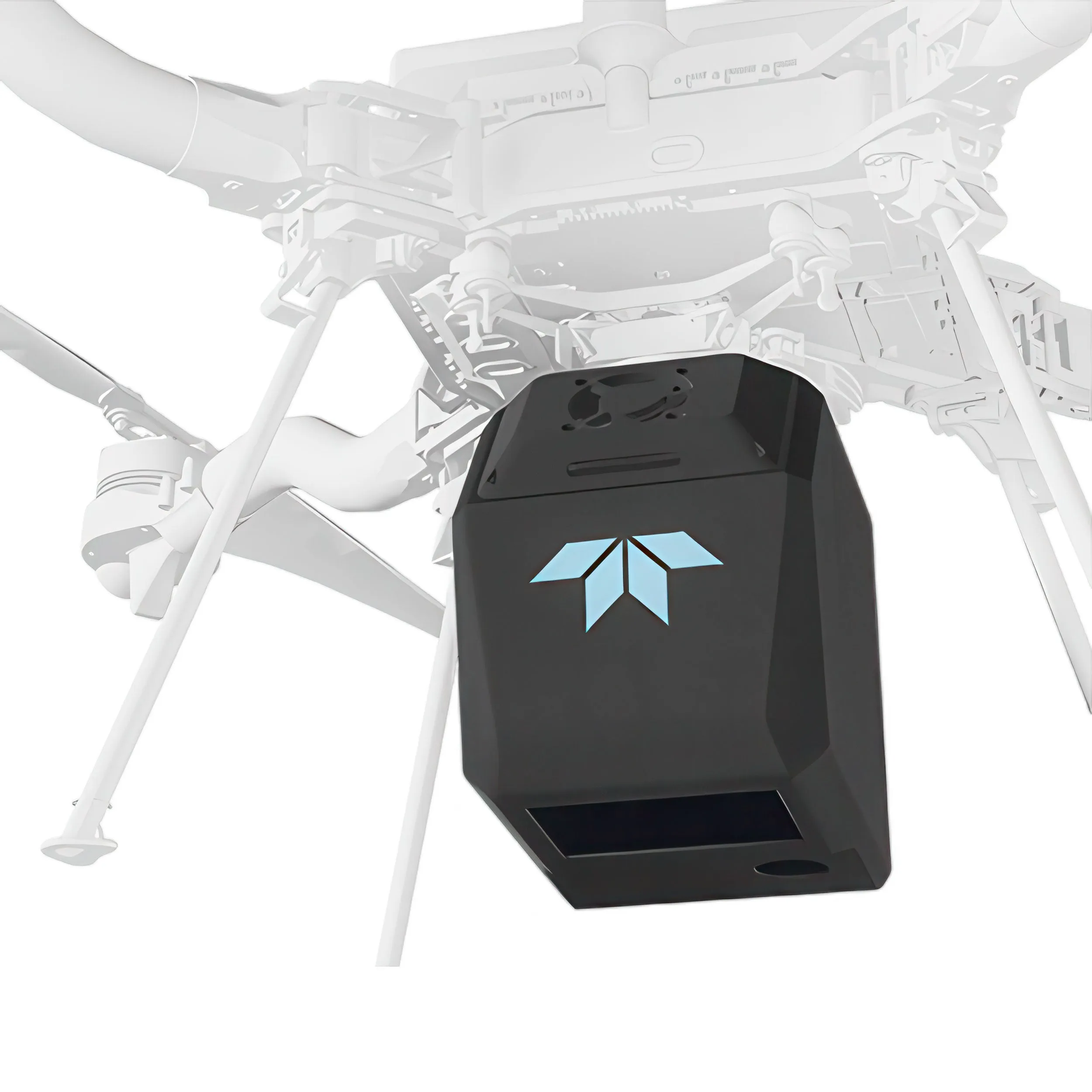
Powered by Inertial Labs RESEPI, the Teledyne Geospatial EchoONE is a secure lightweight airborne laser scanner compatible with UAVs such as the DJI M300/M350, Freefly Astro, Inspired Flight IF800, WISPR Skyscout, and others. For applications such as land surveying, electric utility vegetation management and asset management, and transportation projects, the EchoONE delivers secure, colorized engineering-grade lidar point clouds.
NDAA Compliant and Affordable
EchoONE is designed and manufactured in compliance with the latest NDAA requirements ensuring data security while competitively priced to less secure options.
Long-range and Lightweight
Echo weighs just 1.2kg and can be operated from smaller UAVs such as the Freefly Astro, Inspired Flight IF800 and DJI M300/M350, while operating reliably at a regulatory limit of 120m / 400ft agl delivering an accuracy of up-to 1.5cm RMSZ, ranging precision of 5mm and 0.5mrad 1/e2 beam divergence resulting in clean and precise point clouds.
Accurate and Fast
Full undecimated georeferenced point clouds generated in real-time allowing infield verification combined with rapid post-processing through RESEPI’s “one-click” PC-Master Pro post-processing solution. Full-featured post-processing available with Teledyne Geospatial LMS Professional.
Features:
- Long Range & Canopy Penetration
- 270 m range to 20% reflectivity targets
- Up to 8 returns per pulse
- Wide-Angle Perspective
- 90 deg × 20 deg field of view
- 4 unique vertical scan angles
- Precise Data
- 5 mm lidar ranging precision
- 1.5 cm georeferenced vertical accuracy
- Ultra-Lightweight Design
- EchoONE is 1.2kg
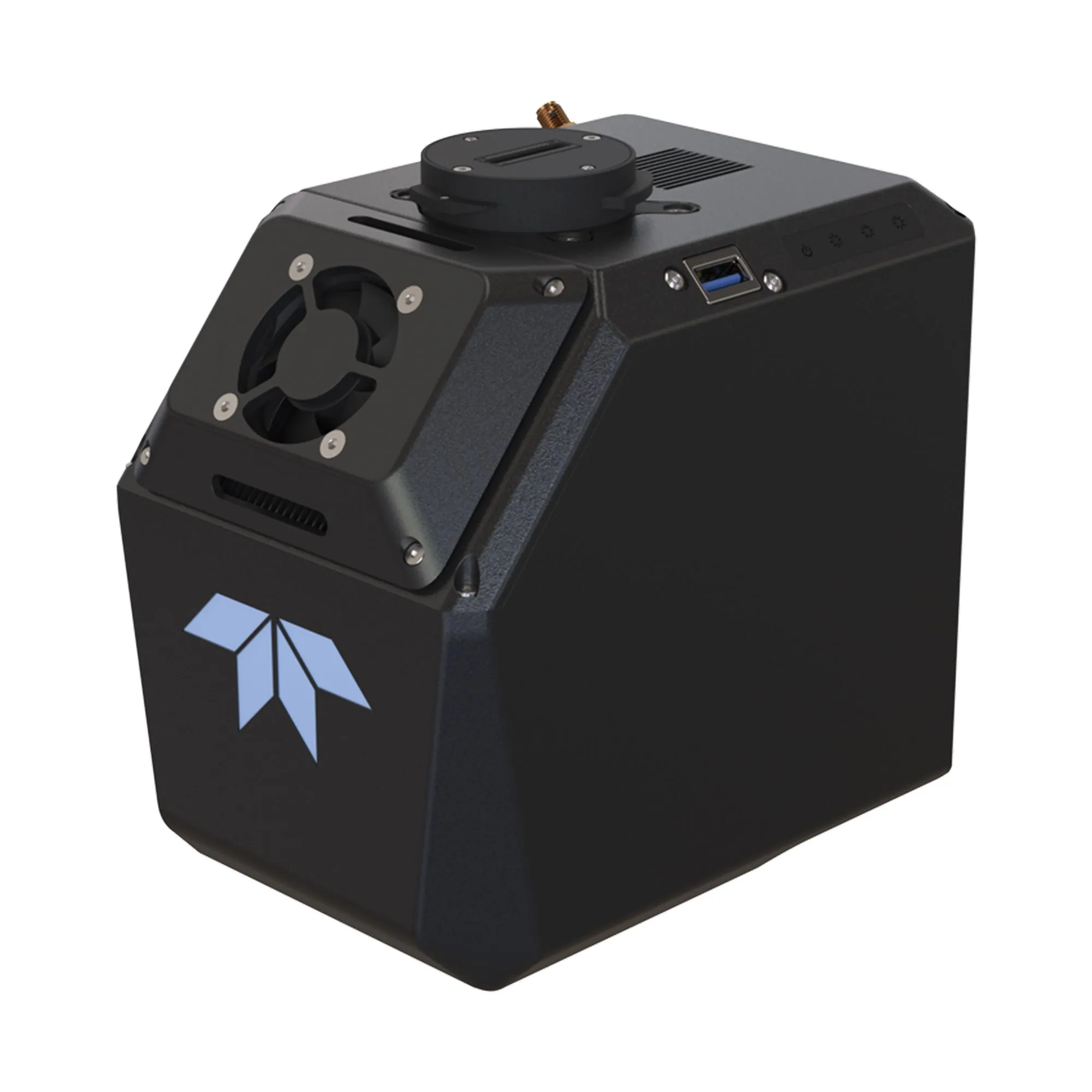
- Integrated Colorization Camera
- Integrated 5MP global shutter camera
- Optional 61MP camera
- High-Accuracy IMU
- Inertial Labs KERNEL-210 tactical grade IMU
Specs
Teledyne Geospatial EchoONE
System
| Absolute Accuracy | 1.5 cm RMSEz @ 120 m |
| Example Area Coverage 30 min, 400 ft/120 m agl 8 m/s, 20% sidelap | 695 acres / 281 ha |
Laser
| Laser Pulse Repetition Frequency | 400 khz | 600 khz |
| Effective Pulse Repetition Frequency | 316 kHz | 474 khz |
| Max. Measuring Range 20% Targets | 1270 m | 225 m |
| Max. Operating Altitude agl, 20% Targets | 205 m | 170 m |
| Returns | Up to 8 per pulse 0.7 m minimum target separation |
| Range Accuracy / Precision, 1sigma | 10 mm / 5 mm |
| Laser Beam Divergence 1/e2 | 0.5 mrad |
| Minimum Range | 3.0 m |
| Horizontal Field-of-View | 90° |
| Vertical Scan Lines | -10°, -4°, 4°, 10° |
| Lines Per Second | Up to 250 |
| Wavelength | 1535 nm |
| Laser Product Classification | Class 1 (IEC 60825-1:2014) |
INS
| Constellation Support | GPS, GLONASS, Galileo, BeiDou, QZSS,NavIC (IRNSS), SBAS, L-Band |
| Frequencies | L1, L2, L5 |
| Pitch / Roll Accuracy | 0.03˚ (RTK); 0.006˚ (PPK) |
| Heading Accuracy | 0.08˚ (RTK); 0.03˚ (PPK) |
Camera
| Internal | 5 MP Global Shutter, 80 deg FOV |
| External | Optional Sony ILX-LR1 |
Environmental
| Operating Temperature | -10C to 50C |
| Storage Temperature | -40C to 85C |
| Ingress Rating | IP54 |
| Compliance | NDAA, CE, RoHS, WEEE, REACH |
Physical
| Size | 170 mm L x 144 mm H x 110 mm W |
| Weight | 1.2 kg |
| Power | 60 W, 9-50 V |
Operational
| Communication | WLAN, Wifi |
| Onboard Storage | 512 GB |
| Removable Storage | USB |
Software
| Inertial Labs PCMaster Pro | One-click post-processing Post-Processing Inertial Data Colorization Point cloud visualization and measurement Automation tools |
| Teledyne LMS Pro (Optional) | Multiple Coordinate Reference Systems Lidar System Calibration Boresight Calibration Strip Alignment Control Point Report Visual Quality control tools |
Options
|
Compatibility
DJI Matrice 350DJI Matrice 300
Freefly Astro
Inspired Flight IF800 TOMCAT
WISPR Skyscout

")


![Maretron Mini Tee [NM-NF-NF]](https://www.advanceddocu.shop/image/maretron-mini-tee-nm-nf-nf_UoLjKy_285x.webp "Maretron Mini Tee [NM-NF-NF]")

